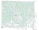
Maps showing Lac Kakahkatshakamat, Petit-Mécatina; Minganie, Quebec
Lac Kakahkatshakamat is a Lake located in Petit-Mécatina; Minganie, Quebec and has an elevation of 145 meters.
- Latitude: 51° 22' 24'' North (decimal: 51.3733968)
- Longitude: 58° 56' 53'' West (decimal: -58.9479962)
- Topography Feature Category: Lake
- Geographical Feature: Lac
- Canadian Province/Territory: Quebec
- Elevation: 145 meters
- Location: Petit-Mécatina; Minganie
- Atlas of Canada Locator Map: Lac Kakahkatshakamat
- GPS Coordinate Locator Map: Lac Kakahkatshakamat Lat/Long
Lac Kakahkatshakamat NTS Map Sheets