Maps showing Portage Kamista, Petit-Mécatina; Minganie, Quebec
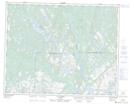
Portage Kamista is a Road feature located in Petit-Mécatina; Minganie, Quebec and has an elevation of 53 meters.
- Latitude: 51° 27' 10'' North (decimal: 51.4528383)
- Longitude: 58° 41' 48'' West (decimal: -58.6965980)
- Topography Feature Category: Road feature
- Geographical Feature: Portage
- Canadian Province/Territory: Quebec
- Elevation: 53 meters
- Location: Petit-Mécatina; Minganie
- Atlas of Canada Locator Map: Portage Kamista
- GPS Coordinate Locator Map: Portage Kamista Lat/Long
Portage Kamista NTS Map Sheets