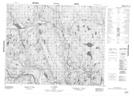
Maps showing Portage Utshask Amitshuatan, Petit-Mécatina; Minganie, Quebec
Portage Utshask Amitshuatan is a Road feature located in Petit-Mécatina; Minganie, Quebec.
- Latitude: 51° 46' 47'' North (decimal: 51.7797909)
- Longitude: 58° 58' 53'' West (decimal: -58.9813223)
- Topography Feature Category: Road feature
- Geographical Feature: Portage
- Canadian Province/Territory: Quebec
- Location: Petit-Mécatina; Minganie
- Atlas of Canada Locator Map: Portage Utshask Amitshuatan
- GPS Coordinate Locator Map: Portage Utshask Amitshuatan Lat/Long
Portage Utshask Amitshuatan NTS Map Sheets