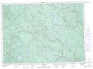
Maps showing Maskinongé, Saint-Léon-le-Grand; Maskinongé, Quebec
Maskinongé is a Major municipal/district area - major agglomeration located in Saint-Léon-le-Grand; Maskinongé, Quebec.
- Latitude: 46° 19' North (decimal: 46.3166666)
- Longitude: 72° 56' West (decimal: -72.9333333)
- Topography Feature Category: Major municipal/district area - major agglomeration
- Geographical Feature: Municipalité régionale de comté
- Canadian Province/Territory: Quebec
- Location: Saint-Léon-le-Grand; Maskinongé
- Atlas of Canada Locator Map: Maskinongé
- GPS Coordinate Locator Map: Maskinongé Lat/Long
Maskinongé NTS Map Sheets