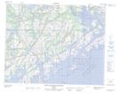
Maps showing Anse Seal, Saint-Augustin; Basse-Côte-Nord, Quebec
Anse Seal is a Bay located in Saint-Augustin; Basse-Côte-Nord, Quebec.
- Latitude: 51° 13' 47'' North (decimal: 51.2297811)
- Longitude: 58° 37' 22'' West (decimal: -58.6227149)
- Topography Feature Category: Bay
- Geographical Feature: Anse
- Canadian Province/Territory: Quebec
- Location: Saint-Augustin; Basse-Côte-Nord
- Atlas of Canada Locator Map: Anse Seal
- GPS Coordinate Locator Map: Anse Seal Lat/Long
Anse Seal NTS Map Sheets