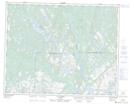
Maps showing Colline Twenty-Five Cent, Saint-Augustin; Basse-Côte-Nord, Quebec
Colline Twenty-Five Cent is a Mountain located in Saint-Augustin; Basse-Côte-Nord, Quebec.
- Latitude: 51° 18' 46'' North (decimal: 51.3128374)
- Longitude: 58° 40' 1'' West (decimal: -58.6668801)
- Topography Feature Category: Mountain
- Geographical Feature: Colline
- Canadian Province/Territory: Quebec
- Location: Saint-Augustin; Basse-Côte-Nord
- Atlas of Canada Locator Map: Colline Twenty-Five Cent
- GPS Coordinate Locator Map: Colline Twenty-Five Cent Lat/Long
Colline Twenty-Five Cent NTS Map Sheets