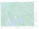
Maps showing Étang Gobeil, Rivière-de-la-Savane; Mékinac, Quebec
Étang Gobeil is a Lake located in Rivière-de-la-Savane; Mékinac, Quebec.
- Latitude: 46° 58' 42'' North (decimal: 46.9783726)
- Longitude: 73° 33' 57'' West (decimal: -73.5659689)
- Topography Feature Category: Lake
- Geographical Feature: Étang
- Canadian Province/Territory: Quebec
- Location: Rivière-de-la-Savane; Mékinac
- Atlas of Canada Locator Map: Étang Gobeil
- GPS Coordinate Locator Map: Étang Gobeil Lat/Long
Étang Gobeil NTS Map Sheets