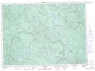
Maps showing Étang Andrée, Lac-Normand; Mékinac, Quebec
Étang Andrée is a Lake located in Lac-Normand; Mékinac, Quebec.
- Latitude: 46° 58' 9'' North (decimal: 46.9692022)
- Longitude: 73° 17' 59'' West (decimal: -73.2998521)
- Topography Feature Category: Lake
- Geographical Feature: Étang
- Canadian Province/Territory: Quebec
- Location: Lac-Normand; Mékinac
- Atlas of Canada Locator Map: Étang Andrée
- GPS Coordinate Locator Map: Étang Andrée Lat/Long
Étang Andrée NTS Map Sheets