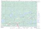
Maps showing Agnew Lake, Sudbury, Ontario
Agnew Lake is a Lake located in Sudbury, Ontario and has an elevation of 263 meters.
- Latitude: 46° 21' 19'' North (decimal: 46.3552777)
- Longitude: 81° 45' 39'' West (decimal: -81.7608333)
- Topography Feature Category: Lake
- Geographical Feature: Lake
- Canadian Province/Territory: Ontario
- Elevation: 263 meters
- Location: Sudbury
- Atlas of Canada Locator Map: Agnew Lake
- GPS Coordinate Locator Map: Agnew Lake Lat/Long