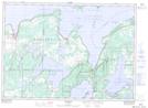
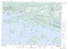
Maps showing Billings, Manitoulin, Ontario
Billings is a Geographical area located in Manitoulin, Ontario.
- Latitude: 45° 51' 13'' North (decimal: 45.8536111)
- Longitude: 82° 12' 25'' West (decimal: -82.2069444)
- Topography Feature Category: Geographical area
- Geographical Feature: Geographic Township
- Canadian Province/Territory: Ontario
- Location: Manitoulin
- Atlas of Canada Locator Map: Billings
- GPS Coordinate Locator Map: Billings Lat/Long
Billings NTS Map Sheets