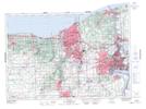
Maps showing Port Weller, Lincoln, Ontario
Port Weller is a Unincorporated area located in Lincoln, Ontario and has an elevation of 81 meters.
- Latitude: 43° 13' 17'' North (decimal: 43.2213888)
- Longitude: 79° 13' 6'' West (decimal: -79.2183333)
- Topography Feature Category: Unincorporated area
- Geographical Feature: Urban Community
- Canadian Province/Territory: Ontario
- Elevation: 81 meters
- Location: Lincoln
- Atlas of Canada Locator Map: Port Weller
- GPS Coordinate Locator Map: Port Weller Lat/Long