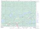
Maps showing Target Rock, Sudbury, Ontario
Target Rock is a Shoal located in Sudbury, Ontario and has an elevation of 253 meters.
- Latitude: 46° 22' 20'' North (decimal: 46.3722222)
- Longitude: 81° 51' 39'' West (decimal: -81.8608333)
- Topography Feature Category: Shoal
- Geographical Feature: Rock
- Canadian Province/Territory: Ontario
- Elevation: 253 meters
- Location: Sudbury
- Atlas of Canada Locator Map: Target Rock
- GPS Coordinate Locator Map: Target Rock Lat/Long