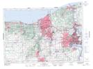
Maps showing Twelve Mile Creek, Lincoln, Ontario
Twelve Mile Creek is a River located in Lincoln, Ontario and has an elevation of 125 meters.
- Latitude: 43° 10' 43'' North (decimal: 43.1786111)
- Longitude: 79° 16' 21'' West (decimal: -79.2724999)
- Topography Feature Category: River
- Geographical Feature: Creek
- Canadian Province/Territory: Ontario
- Elevation: 125 meters
- Location: Lincoln
- Atlas of Canada Locator Map: Twelve Mile Creek
- GPS Coordinate Locator Map: Twelve Mile Creek Lat/Long