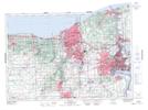
Maps showing The Whirlpool, Lincoln, Ontario
The Whirlpool is a Rapids located in Lincoln, Ontario and has an elevation of 109 meters.
- Latitude: 43° 7' 18'' North (decimal: 43.1216666)
- Longitude: 79° 4' 17'' West (decimal: -79.0713888)
- Topography Feature Category: Rapids
- Geographical Feature: Whirlpool
- Canadian Province/Territory: Ontario
- Elevation: 109 meters
- Location: Lincoln
- Atlas of Canada Locator Map: The Whirlpool
- GPS Coordinate Locator Map: The Whirlpool Lat/Long