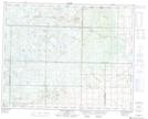
Maps showing Baldy Mountain, 29-24-W, Manitoba
Baldy Mountain is a Mountain located in 29-24-W, Manitoba and has an elevation of 801 meters.
- Latitude: 51° 28' 7'' North (decimal: 51.4686000)
- Longitude: 100° 43' 42'' West (decimal: -100.7282999)
- Topography Feature Category: Mountain
- Geographical Feature: Mountain
- Canadian Province/Territory: Manitoba
- Elevation: 801 meters
- Location: 29-24-W
- Atlas of Canada Locator Map: Baldy Mountain
- GPS Coordinate Locator Map: Baldy Mountain Lat/Long
Baldy Mountain NTS Map Sheets