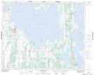
Maps showing Blank Island, 16,17,20-32-15-W, Manitoba
Blank Island is a Island located in 16,17,20-32-15-W, Manitoba and has an elevation of 259 meters.
- Latitude: 51° 45' 9'' North (decimal: 51.7525000)
- Longitude: 99° 32' 20'' West (decimal: -99.5389000)
- Topography Feature Category: Island
- Geographical Feature: Island
- Canadian Province/Territory: Manitoba
- Elevation: 259 meters
- Location: 16,17,20-32-15-W
- Atlas of Canada Locator Map: Blank Island
- GPS Coordinate Locator Map: Blank Island Lat/Long
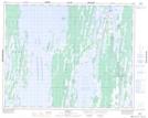
Blank Island NTS Map Sheets