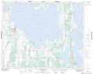
Maps showing Long Island, 32-16-W, Manitoba
Long Island is a Island located in 32-16-W, Manitoba and has an elevation of 266 meters.
- Latitude: 51° 44' 58'' North (decimal: 51.7494000)
- Longitude: 99° 41' 14'' West (decimal: -99.6871999)
- Topography Feature Category: Island
- Geographical Feature: Island
- Canadian Province/Territory: Manitoba
- Elevation: 266 meters
- Location: 32-16-W
- Atlas of Canada Locator Map: Long Island
- GPS Coordinate Locator Map: Long Island Lat/Long
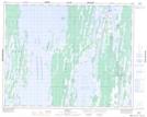
Long Island NTS Map Sheets