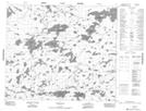
Maps showing Gibson Point, 63-23E1, Manitoba
Gibson Point is a Cape located in 63-23E1, Manitoba.
- Latitude: 54° 28' 58'' North (decimal: 54.4828000)
- Longitude: 94° 2' 1'' West (decimal: -94.0336000)
- Topography Feature Category: Cape
- Geographical Feature: Point
- Canadian Province/Territory: Manitoba
- Location: 63-23E1
- Atlas of Canada Locator Map: Gibson Point
- GPS Coordinate Locator Map: Gibson Point Lat/Long
Gibson Point NTS Map Sheets