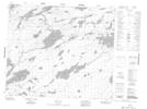
Maps showing Guiboche Island, 65-12E, Manitoba
Guiboche Island is a Island located in 65-12E, Manitoba.
- Latitude: 54° 39' 32'' North (decimal: 54.6588999)
- Longitude: 95° 47' 10'' West (decimal: -95.7860999)
- Topography Feature Category: Island
- Geographical Feature: Island
- Canadian Province/Territory: Manitoba
- Location: 65-12E
- Atlas of Canada Locator Map: Guiboche Island
- GPS Coordinate Locator Map: Guiboche Island Lat/Long
Guiboche Island NTS Map Sheets