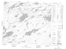
Maps showing Powers Point, 64-12E, Manitoba
Powers Point is a Cape located in 64-12E, Manitoba.
- Latitude: 54° 34' 27'' North (decimal: 54.5741999)
- Longitude: 95° 40' 47'' West (decimal: -95.6796999)
- Topography Feature Category: Cape
- Geographical Feature: Point
- Canadian Province/Territory: Manitoba
- Location: 64-12E
- Atlas of Canada Locator Map: Powers Point
- GPS Coordinate Locator Map: Powers Point Lat/Long
Powers Point NTS Map Sheets