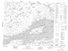
Maps showing Lloyd Island, 67-12E, Manitoba
Lloyd Island is a Island located in 67-12E, Manitoba.
- Latitude: 54° 46' 16'' North (decimal: 54.7710999)
- Longitude: 95° 45' 37'' West (decimal: -95.7603000)
- Topography Feature Category: Island
- Geographical Feature: Island
- Canadian Province/Territory: Manitoba
- Location: 67-12E
- Atlas of Canada Locator Map: Lloyd Island
- GPS Coordinate Locator Map: Lloyd Island Lat/Long
Lloyd Island NTS Map Sheets