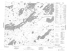
Maps showing Wickstrom Island, 69-18E, Manitoba
Wickstrom Island is a Island located in 69-18E, Manitoba.
- Latitude: 54° 57' 37'' North (decimal: 54.9602999)
- Longitude: 94° 49' 17'' West (decimal: -94.8213999)
- Topography Feature Category: Island
- Geographical Feature: Island
- Canadian Province/Territory: Manitoba
- Location: 69-18E
- Atlas of Canada Locator Map: Wickstrom Island
- GPS Coordinate Locator Map: Wickstrom Island Lat/Long
Wickstrom Island NTS Map Sheets