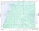
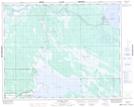
Maps showing The Narrows 49A, Manitoba
The Narrows 49A is a Indian Reserve located in Manitoba.
- Latitude: 51° 43' 23'' North (decimal: 51.7230999)
- Longitude: 98° 22' 11'' West (decimal: -98.3696999)
- Topography Feature Category: Indian Reserve
- Geographical Feature: Indian Reserve - Réserve indienne
- Canadian Province/Territory: Manitoba
- Atlas of Canada Locator Map: The Narrows 49A
- GPS Coordinate Locator Map: The Narrows 49A Lat/Long
The Narrows 49A NTS Map Sheets