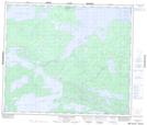
Maps showing Andrew Bay, Manitoba
Andrew Bay is a Indian Reserve located in Manitoba.
- Latitude: 54° 26' 28'' North (decimal: 54.4411653)
- Longitude: 94° 38' 24'' West (decimal: -94.6398953)
- Topography Feature Category: Indian Reserve
- Geographical Feature: Indian Reserve - Réserve indienne
- Canadian Province/Territory: Manitoba
- Atlas of Canada Locator Map: Andrew Bay
- GPS Coordinate Locator Map: Andrew Bay Lat/Long
Andrew Bay NTS Map Sheets