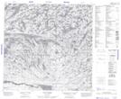
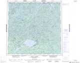
Maps showing Stony Rapids, Saskatchewan
Stony Rapids is a Hamlet located in Saskatchewan and has an elevation of 240 meters.
- Latitude: 59° 15' 17'' North (decimal: 59.2548055)
- Longitude: 105° 50' 19'' West (decimal: -105.8386667)
- Topography Feature Category: Hamlet
- Geographical Feature: Northern Hamlet
- Canadian Province/Territory: Saskatchewan
- Elevation: 240 meters
- Atlas of Canada Locator Map: Stony Rapids
- GPS Coordinate Locator Map: Stony Rapids Lat/Long
Stony Rapids NTS Map Sheets