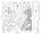
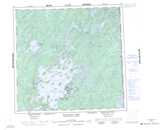
Maps showing South Arm, Saskatchewan
South Arm is a Cape located in Saskatchewan and has an elevation of 401 meters.
- Latitude: 58° 16' North (decimal: 58.2668042)
- Longitude: 103° 40' West (decimal: -103.6671295)
- Topography Feature Category: Cape
- Geographical Feature: Peninsula
- Canadian Province/Territory: Saskatchewan
- Elevation: 401 meters
- Atlas of Canada Locator Map: South Arm
- GPS Coordinate Locator Map: South Arm Lat/Long
South Arm NTS Map Sheets