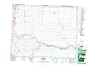
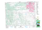
Maps showing Ogden, 25-23-1-W5, Alberta
Ogden is a Unincorporated area located in 25-23-1-W5, Alberta and has an elevation of 1030 meters.
- Latitude: 50° 58' 58'' North (decimal: 50.9827778)
- Longitude: 113° 59' 40'' West (decimal: -113.9944444)
- Topography Feature Category: Unincorporated area
- Geographical Feature: Railway Point
- Canadian Province/Territory: Alberta
- Elevation: 1030 meters
- Location: 25-23-1-W5
- Atlas of Canada Locator Map: Ogden
- GPS Coordinate Locator Map: Ogden Lat/Long
Ogden NTS Map Sheets