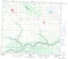
Maps showing Saskatoon Island Provincial Park, 72-7,8-W6, Alberta
Saskatoon Island Provincial Park is a Conservation area located in 72-7,8-W6, Alberta.
- Latitude: 55° 12' 14'' North (decimal: 55.2038889)
- Longitude: 119° 5' 8'' West (decimal: -119.0855555)
- Topography Feature Category: Conservation area
- Geographical Feature: Provincial Park
- Canadian Province/Territory: Alberta
- Location: 72-7,8-W6
- Atlas of Canada Locator Map: Saskatoon Island Provincial Park
- GPS Coordinate Locator Map: Saskatoon Island Provincial Park Lat/Long
Saskatoon Island Provincial Park NTS Map Sheets