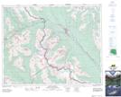
Maps showing Kingfisher Lake, 32-28-16-W5, Alberta
Kingfisher Lake is a Lake located in 32-28-16-W5, Alberta and has an elevation of 1536 meters.
- Latitude: 51° 24' 38'' North (decimal: 51.4105555)
- Longitude: 116° 9' 41'' West (decimal: -116.1613889)
- Topography Feature Category: Lake
- Geographical Feature: Lake
- Canadian Province/Territory: Alberta
- Elevation: 1536 meters
- Location: 32-28-16-W5
- Atlas of Canada Locator Map: Kingfisher Lake
- GPS Coordinate Locator Map: Kingfisher Lake Lat/Long