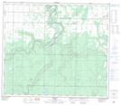
Maps showing DeBolt, 12-71-1-W6, Alberta
DeBolt is a Unincorporated area located in 12-71-1-W6, Alberta and has an elevation of 640 meters.
- Latitude: 55° 13' 18'' North (decimal: 55.2216666)
- Longitude: 118° 1' 13'' West (decimal: -118.0202778)
- Topography Feature Category: Unincorporated area
- Geographical Feature: Hamlet
- Canadian Province/Territory: Alberta
- Elevation: 640 meters
- Location: 12-71-1-W6
- Atlas of Canada Locator Map: DeBolt
- GPS Coordinate Locator Map: DeBolt Lat/Long
DeBolt NTS Map Sheets