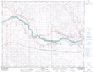
Maps showing Atlee, 5-22-7-W4, Alberta
Atlee is a Unincorporated area located in 5-22-7-W4, Alberta and has an elevation of 773 meters.
- Latitude: 50° 50' 30'' North (decimal: 50.8416667)
- Longitude: 110° 57' 1'' West (decimal: -110.9502777)
- Topography Feature Category: Unincorporated area
- Geographical Feature: Locality
- Canadian Province/Territory: Alberta
- Elevation: 773 meters
- Location: 5-22-7-W4
- Atlas of Canada Locator Map: Atlee
- GPS Coordinate Locator Map: Atlee Lat/Long
Atlee NTS Map Sheets