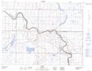
Maps showing Prairie Island, 4-13-12-W4, Alberta
Prairie Island is a Island located in 4-13-12-W4, Alberta.
- Latitude: 50° 3' North (decimal: 50.0499999)
- Longitude: 111° 35' West (decimal: -111.5832999)
- Topography Feature Category: Island
- Geographical Feature: Island
- Canadian Province/Territory: Alberta
- Location: 4-13-12-W4
- GPS Coordinate Locator Map: Prairie Island Lat/Long