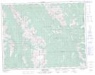
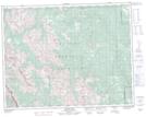
Maps showing Elk Range, 17,18,19-7,8-W5, Alberta
Elk Range is a Mountain located in 17,18,19-7,8-W5, Alberta and has an elevation of 2420 meters.
- Latitude: 50° 31' 9'' North (decimal: 50.5191666)
- Longitude: 114° 57' 14'' West (decimal: -114.9538888)
- Topography Feature Category: Mountain
- Geographical Feature: Range
- Canadian Province/Territory: Alberta
- Elevation: 2420 meters
- Location: 17,18,19-7,8-W5
- Atlas of Canada Locator Map: Elk Range
- GPS Coordinate Locator Map: Elk Range Lat/Long
Elk Range NTS Map Sheets