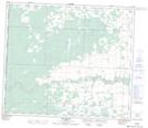
Maps showing Elmworth, 9-70-11-W6, Alberta
Elmworth is a Unincorporated area located in 9-70-11-W6, Alberta and has an elevation of 716 meters.
- Latitude: 55° 3' 14'' North (decimal: 55.0538888)
- Longitude: 119° 36' 57'' West (decimal: -119.6158333)
- Topography Feature Category: Unincorporated area
- Geographical Feature: Locality
- Canadian Province/Territory: Alberta
- Elevation: 716 meters
- Location: 9-70-11-W6
- Atlas of Canada Locator Map: Elmworth
- GPS Coordinate Locator Map: Elmworth Lat/Long
Elmworth NTS Map Sheets