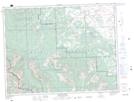
Maps showing Barnaby Creek, 9-5-3-W5, Alberta
Barnaby Creek is a River located in 9-5-3-W5, Alberta and has an elevation of 1588 meters.
- Latitude: 49° 21' 55'' North (decimal: 49.3652777)
- Longitude: 114° 20' 41'' West (decimal: -114.3447222)
- Topography Feature Category: River
- Geographical Feature: Creek
- Canadian Province/Territory: Alberta
- Elevation: 1588 meters
- Location: 9-5-3-W5
- Atlas of Canada Locator Map: Barnaby Creek
- GPS Coordinate Locator Map: Barnaby Creek Lat/Long
Barnaby Creek NTS Map Sheets