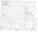
Maps showing Bear Hills, 44,45-25-W4, Alberta
Bear Hills is a Mountain located in 44,45-25-W4, Alberta and has an elevation of 862 meters.
- Latitude: 52° 51' 23'' North (decimal: 52.8563888)
- Longitude: 113° 32' 8'' West (decimal: -113.5355555)
- Topography Feature Category: Mountain
- Geographical Feature: Hills
- Canadian Province/Territory: Alberta
- Elevation: 862 meters
- Location: 44,45-25-W4
- Atlas of Canada Locator Map: Bear Hills
- GPS Coordinate Locator Map: Bear Hills Lat/Long
Bear Hills NTS Map Sheets