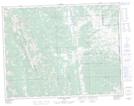
Maps showing Livingstone Falls, 23-13-W4, Alberta
Livingstone Falls is a Falls located in 23-13-W4, Alberta and has an elevation of 1710 meters.
- Latitude: 50° 6' 9'' North (decimal: 50.1025000)
- Longitude: 114° 26' 37'' West (decimal: -114.4436110)
- Topography Feature Category: Falls
- Geographical Feature: Falls
- Canadian Province/Territory: Alberta
- Elevation: 1710 meters
- Location: 23-13-W4
- Atlas of Canada Locator Map: Livingstone Falls
- GPS Coordinate Locator Map: Livingstone Falls Lat/Long
Livingstone Falls NTS Map Sheets