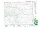
Maps showing Lochend Lake, 27-3-W5, Alberta
Lochend Lake is a Lake located in 27-3-W5, Alberta and has an elevation of 1260 meters.
- Latitude: 51° 20' 5'' North (decimal: 51.3347221)
- Longitude: 114° 19' 6'' West (decimal: -114.3183333)
- Topography Feature Category: Lake
- Geographical Feature: Lake
- Canadian Province/Territory: Alberta
- Elevation: 1260 meters
- Location: 27-3-W5
- Atlas of Canada Locator Map: Lochend Lake
- GPS Coordinate Locator Map: Lochend Lake Lat/Long