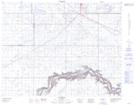
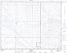
Maps showing Ralston, 10-15-9-W5, Alberta
Ralston is a Unincorporated area located in 10-15-9-W5, Alberta and has an elevation of 758 meters.
- Latitude: 50° 14' 45'' North (decimal: 50.2458333)
- Longitude: 111° 10' 7'' West (decimal: -111.1686110)
- Topography Feature Category: Unincorporated area
- Geographical Feature: Hamlet
- Canadian Province/Territory: Alberta
- Elevation: 758 meters
- Location: 10-15-9-W5
- Atlas of Canada Locator Map: Ralston
- GPS Coordinate Locator Map: Ralston Lat/Long
Ralston NTS Map Sheets