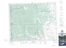
Maps showing Ranche Hill, 1,12,13-27-6-W5, Alberta
Ranche Hill is a Mountain located in 1,12,13-27-6-W5, Alberta and has an elevation of 1425 meters.
- Latitude: 51° 18' 26'' North (decimal: 51.3072222)
- Longitude: 114° 43' 16'' West (decimal: -114.7211110)
- Topography Feature Category: Mountain
- Geographical Feature: Hill
- Canadian Province/Territory: Alberta
- Elevation: 1425 meters
- Location: 1,12,13-27-6-W5
- Atlas of Canada Locator Map: Ranche Hill
- GPS Coordinate Locator Map: Ranche Hill Lat/Long
Ranche Hill NTS Map Sheets