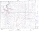
Maps showing Red Deer Lake, 15,16-3-W4, Alberta
Red Deer Lake is a Lake located in 15,16-3-W4, Alberta and has an elevation of 752 meters.
- Latitude: 50° 17' 43'' North (decimal: 50.2952777)
- Longitude: 110° 24' 31'' West (decimal: -110.4086110)
- Topography Feature Category: Lake
- Geographical Feature: Lake
- Canadian Province/Territory: Alberta
- Elevation: 752 meters
- Location: 15,16-3-W4
- Atlas of Canada Locator Map: Red Deer Lake
- GPS Coordinate Locator Map: Red Deer Lake Lat/Long