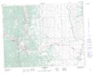
Maps showing Lundbreck, 25,26-7-2-W5, Alberta
Lundbreck is a Unincorporated area located in 25,26-7-2-W5, Alberta and has an elevation of 1200 meters.
- Latitude: 49° 35' 8'' North (decimal: 49.5855555)
- Longitude: 114° 9' 43'' West (decimal: -114.1619444)
- Topography Feature Category: Unincorporated area
- Geographical Feature: Hamlet
- Canadian Province/Territory: Alberta
- Elevation: 1200 meters
- Location: 25,26-7-2-W5
- Atlas of Canada Locator Map: Lundbreck
- GPS Coordinate Locator Map: Lundbreck Lat/Long