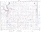
Maps showing Roseglen, 34-15-3-W4, Alberta
Roseglen is a Unincorporated area located in 34-15-3-W4, Alberta and has an elevation of 797 meters.
- Latitude: 50° 18' North (decimal: 50.2999999)
- Longitude: 110° 21' West (decimal: -110.3499999)
- Topography Feature Category: Unincorporated area
- Geographical Feature: Locality
- Canadian Province/Territory: Alberta
- Elevation: 797 meters
- Location: 34-15-3-W4
- GPS Coordinate Locator Map: Roseglen Lat/Long