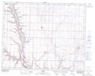
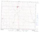
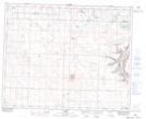
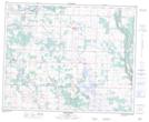
Maps showing Ghostpine Creek, 14-30-22-W4, Alberta
Ghostpine Creek is a River located in 14-30-22-W4, Alberta and has an elevation of 804 meters.
- Latitude: 51° 33' 45'' North (decimal: 51.5624999)
- Longitude: 112° 59' 3'' West (decimal: -112.9841666)
- Topography Feature Category: River
- Geographical Feature: Creek
- Canadian Province/Territory: Alberta
- Elevation: 804 meters
- Location: 14-30-22-W4
- Atlas of Canada Locator Map: Ghostpine Creek
- GPS Coordinate Locator Map: Ghostpine Creek Lat/Long
Ghostpine Creek NTS Map Sheets