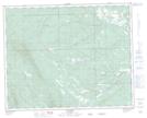
Maps showing Forty-five Mile Creek, 16-37-10-W5, Alberta
Forty-five Mile Creek is a River located in 16-37-10-W5, Alberta.
- Latitude: 52° 11' 1'' North (decimal: 52.1836110)
- Longitude: 115° 22' 27'' West (decimal: -115.3741667)
- Topography Feature Category: River
- Geographical Feature: Creek
- Canadian Province/Territory: Alberta
- Location: 16-37-10-W5
- Atlas of Canada Locator Map: Forty-five Mile Creek
- GPS Coordinate Locator Map: Forty-five Mile Creek Lat/Long
Forty-five Mile Creek NTS Map Sheets