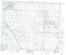
Maps showing Ma-Me-O Beach, 14-46-28-W4, Alberta
Ma-Me-O Beach is a Village located in 14-46-28-W4, Alberta and has an elevation of 853 meters.
- Latitude: 52° 58' 21'' North (decimal: 52.9724998)
- Longitude: 113° 57' 53'' West (decimal: -113.9647221)
- Topography Feature Category: Village
- Geographical Feature: Summer Village
- Canadian Province/Territory: Alberta
- Elevation: 853 meters
- Location: 14-46-28-W4
- Atlas of Canada Locator Map: Ma-Me-O Beach
- GPS Coordinate Locator Map: Ma-Me-O Beach Lat/Long
Ma-Me-O Beach NTS Map Sheets