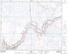
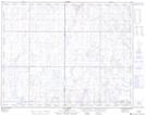
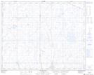
Maps showing Blood Indian Creek, 22-8-W4, Alberta
Blood Indian Creek is a River located in 22-8-W4, Alberta and has an elevation of 649 meters.
- Latitude: 50° 54' 52'' North (decimal: 50.9144444)
- Longitude: 111° 3' 41'' West (decimal: -111.0613889)
- Topography Feature Category: River
- Geographical Feature: Creek
- Canadian Province/Territory: Alberta
- Elevation: 649 meters
- Location: 22-8-W4
- Atlas of Canada Locator Map: Blood Indian Creek
- GPS Coordinate Locator Map: Blood Indian Creek Lat/Long
Blood Indian Creek NTS Map Sheets