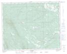
Maps showing Seven Mile Flat, 35-10-W5, Alberta
Seven Mile Flat is a Beach located in 35-10-W5, Alberta and has an elevation of 1339 meters.
- Latitude: 52° 0' 5'' North (decimal: 52.0013889)
- Longitude: 115° 22' 38'' West (decimal: -115.3772221)
- Topography Feature Category: Beach
- Geographical Feature: Flat
- Canadian Province/Territory: Alberta
- Elevation: 1339 meters
- Location: 35-10-W5
- Atlas of Canada Locator Map: Seven Mile Flat
- GPS Coordinate Locator Map: Seven Mile Flat Lat/Long
Seven Mile Flat NTS Map Sheets