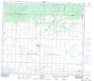
Maps showing Sexsmith, 25-73-6-W6, Alberta
Sexsmith is a Town located in 25-73-6-W6, Alberta and has an elevation of 719 meters.
- Latitude: 55° 21' 1'' North (decimal: 55.3502777)
- Longitude: 118° 46' 54'' West (decimal: -118.7816666)
- Topography Feature Category: Town
- Geographical Feature: Town
- Canadian Province/Territory: Alberta
- Elevation: 719 meters
- Location: 25-73-6-W6
- Atlas of Canada Locator Map: Sexsmith
- GPS Coordinate Locator Map: Sexsmith Lat/Long
Sexsmith NTS Map Sheets