Canada Topographic Maps

Grande Prairie Topo Maps

Topography maps and Latitude/Longitude Location

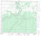
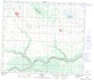
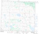
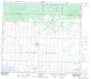
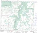
Maps showing Grande Prairie, 71,72-5,6,7-W6, Alberta

Grande Prairie is a Low vegetation located in 71,72-5,6,7-W6, Alberta and has an elevation of 741 meters.

  • Latitude: 55° 12' North   (decimal: 55.2000000)
  • Longitude: 118° 48' West   (decimal: -118.7999999)
  • Topography Feature Category: Low vegetation
  • Geographical Feature: Prairie
  • Canadian Province/Territory: Alberta
  • Elevation: 741 meters
  • Location: 71,72-5,6,7-W6
  • Atlas of Canada Locator Map: Grande Prairie
  • GPS Coordinate Locator Map: Grande Prairie Lat/Long

Grande Prairie NTS Map Sheets

083M01 Debolt Topographic Map at 1:50,000 scale

083M02 Grande Prairie Topographic Map at 1:50,000 scale

083M03 Wembley Topographic Map at 1:50,000 scale

083M06 La Glace Topographic Map at 1:50,000 scale

083M07 Sexsmith Topographic Map at 1:50,000 scale

083M08 Smoky Heights Topographic Map at 1:50,000 scale

083M Grande Prairie Topographic Map at 1:250,000 scale

 
Buy Topographic Maps DVD
Newsletter Sign-up

Yes, I want to receive map store discounts.


Bookmark and Share